Dungog attractions and accommodation for those contemplating a memorable escape to the country or researching a move to an idyllic and slower paced lifestyle.
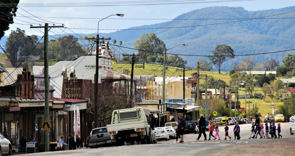
The picturesque township of Dungog, located in New South Wales, Australia, is steeped in history and charm. With its charming heritage buildings, beautiful parks and gardens, and rich cultural tapestry, this small town offers an authentic taste of rural life that attracts visitors from all over.
Dungog boasts many attractions including antique shops, cafes, restaurants serving local produce, art galleries and museums as well as scenic walks and drives through the surrounding hills, valleys and farmland, allowing guests to experience firsthand the stunning beauty of the region. Visitors can also explore the nearby Barrington Tops National Park, which is home to a wide range of flora and fauna and offers plenty of hiking trails. Additionally, Dungog hosts events such as markets, festivals and concerts throughout the year. All these make it a wonderful destination for anyone seeking a relaxing holiday amidst nature and culture. For further information see the Dungog Visitor Information Centre
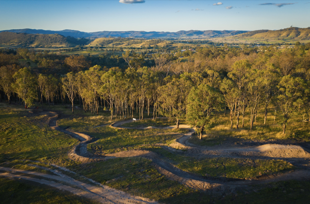
The Common Reserve
Dungog Common Reserve is home to some of Australia’s best mountain biking terrain, making it an ideal destination for riders of all skill levels. With over 40 kilometers of purpose-built tracks, this recreational reserve offers an unforgettable outdoor experience in a picturesque natural setting. More Information
Barrington Tops World Heritage
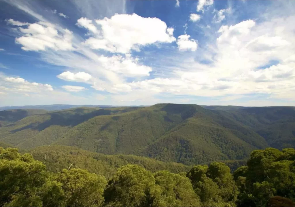
Immerse yourself in the World Heritage-listed Gondwana Rainforests of Barrington Tops National Park. Easy walks, overnight hikes, great picnic, fishing and camping spots await. If you’re interested in exploring the Barrington Tops National Park while staying in Dungog, then you’ll be happy to know that access to the park is relatively straightforward. Here are some options from NSW National Parks:
Southern Barrington Tops:
- From Dungog, take Chichester Dam Road for about 10km before turning left on Salisbury Road.
- After about 27km, you’ll reach the Lagoon Pinch to Williams River precinct of the park.
Eastern Barrington Tops:
- From Gloucester, take Bucketts Way before turning right onto Gloucester Tops Road.
- After about 30km, you’ll reach the Gloucester River precinct of the park, and further on you’ll find the Gloucester Tops precinct.
Northern Barrington Tops:
From Gloucester:
- Take Thunderbolts Way, which becomes Scone Road and Barrington Tops Forest Road.
- After about 45km, you’ll reach Cobark picnic area.
- Continue on for other sites within Polblue and Devils Hole precinct of the park.
Gloucester
Gloucester is about 62km from Gloucester and the drive will take about 57 minutes
More Information?
Barrington Tops History Towns
Other history is well preserved in small museums. Those at Gloucester, Paterson, Dungog and Clarence Town are open at advertised hours at weekends or by appointment. For more information, see: Historic Towns.